The Dolomites are the favourite place for hikers all arounf the world. From easy hikes in the meadows to challenging hikes for the adrenaline junkies, the Dolomites offer great hike for people of all age.
If you are planning a hiking trip in the Dolomites, Italy, you need to know all about dolomites hiking trails and choose the one that is appropriate for you. There are some easy short hikes, and some are difficult hikes with huge rewards.
In this hiking guide, we’ve listed the 24 Best Hikes in the Dolomites, with maps and details of each hikes. So read on for our favorite hikes on this list!
Best Time To Go Hiking In The Dolomites
The official hiking season in the Dolomites typically starts in May and end until the end of October. But it depends on snowfall. Some short hikes are do-able with less snow. But the higher hikes will be restricted after October.
I have been to Dolomites 6 times and amongst 12 months, these three months are the best time to get the most out of the beautiful hikes in the Dolomites
1. June: In this month, summer is coming, and temperature is still rising. Tourists are less and lush green flourish. You will see wildflower in the meadows and hiking trail and sweet earthy smell all over the trails.
2. September: The sunny side up, with warm weather. Tourists start to raise during this month. It’s also a best month to see captivating cloud inversions.
3. October: This is the best month for the sunrise and sunset photography in the Dolomites. Professional photographer with their camera and hiking gears are seen in the hiking trails. But during this month you may encounter snowy terrain in some high hikes.
24 Best Hikes in The Dolomites Ranked
1. Tre Cime di Lavaredo Hike
Hiking Distance: 10km
Elevation Gain/Loss: 340 meters
Route Type: Loop Trail
Level: Easy-Moderate.
Duration: 3.5 hours
Parking Lot: Rifugio Auronzo
Best time to visit: Early morning to avoid crowd
Season: June to end of October
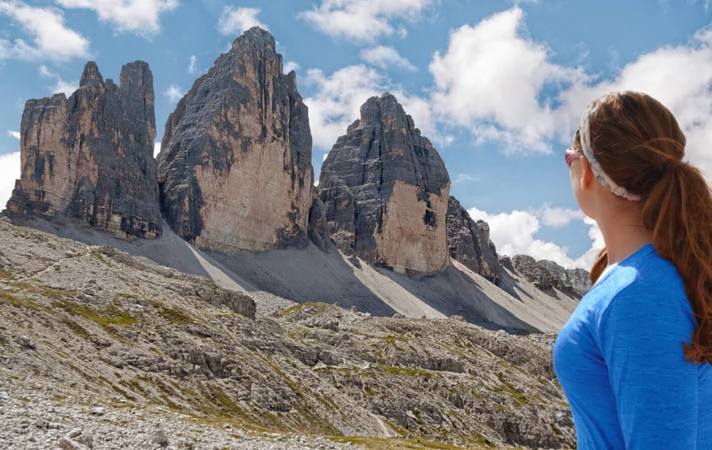
The Tre Cime di Lavaredo Circuit is the most popular hiking trail in the Dolomites and you definitely shouldn’t miss it if you’re visiting the South Tyrolean region for the first time.
This hiking trail takes you to the famous three peaks in the Tre Cime National Park, which is a Dolomites UNESCO World Heritage site. It’s considered the best day hike in the Italian Dolomites because it’s easy to get to and offers breathtaking views.
There are tons of hiking trails in Tre Cime National Park, but this one is hands down the best for seeing the Drei Zinnen.
The trek starts at the famous rifugio Auronzo and takes about 4 hours to finish. If you’re into photography, make sure to factor in an extra hour because the views on this part of the hike are absolutely breathtaking.
I highly recommend starting early in the morning because it’s one of the must-do activities in the Dolomites. Begin your walk at sunrise, and you’ll have an amazing time without dealing with crowds of people.
Tours & Things to do hand-picked by our insiders
To reach the hiking trail, you’ll need to pass through a toll booth. It costs €30 for a regular car to go up, and the toll road is open 24/7.
The Tre Cime di Lavaredo circuit starts at Rifugio Auronzo in Auronzo di Cadore, which you can easily reach by car or bus through a toll road.
2. Lago di Federa- Day Hike
Hiking Distance: 8.4 km
Elevation Gain/Loss: 469 meters
Route Type: Out & Back
Difficulty Level: Moderate
Duration: 3 hours
Parking Lot: Ponte de Ru Curto
Best time to visit: Sunrise is the best time to hike this trail. October sunrise gives a surreal experience.
Season: Mid June to October end.
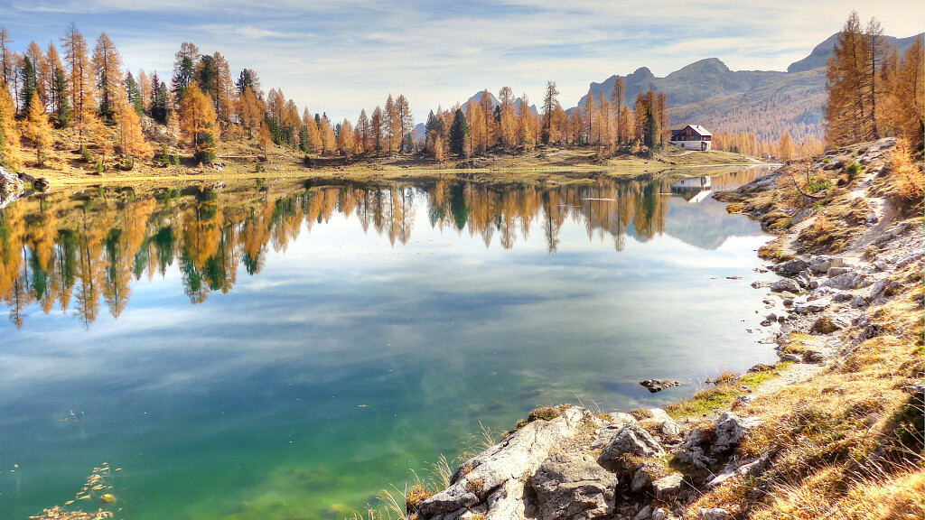
A visit to Lago di Federa might not be on your dolomites itinerary when planning a trip to the Dolomites, but you definitely should!
Lago di Federa is a beautiful clear lake up in the mountains near Val Gardena. It’s surrounded by lots of larch trees that look amazing in the Fall.
The hike to Lago di Federa is actually part of the Croda do Lago hike! If you have enough time, I recommend doing the whole loop which takes around 7 to 8 hours.
But if you’re short on time, you can just follow the trail to the lake and then turn back at the Cason di Formin trail intersection.
To get there, take the left path, trail 434, towards Rifugio Croda da Lago/G. Palmieri. The trail gets steeper. You will have to climb through some rocky areas, but the views are incredible.
There’s even a lookout point off the main trail where you can see Cinque Torri, Nuvolau, Tofana di Rozes, the Pomagagnon, and the Sorapiss Group.
After a while, the path levels out and you’ll pass through Val Negra to reach Lago Federa, the famous lake beneath the eastern wall of Croda da Lago.
If you want one of the best viewpoints of the lake and Becco di Mezzodi, head to the lakeshore and follow the western shore around to Rifugio Croda da Lago (also known as Rifugio Palmieri).
I did this hike in late October. But best believe there was already snow on the ground! If that’s the case when you go, make sure to bring hiking poles because the trail can be pretty steep and slippery. It took me about 3 hours to hike up and back down, but I’m sure you can do it faster if there’s no snow and ice.
3. Seceda Panorama- Beautiful Hike
Hiking Distance: 8.9 km circuit
Elevation Gain/Loss: 524 meters
Route Type: Cross and a circular
Difficulty Level: Easy – Moderate
Hike Duration: 3.15 hours
Parking Lot: Above Santa Cristina
Best time to visit: Most beautiful during surise. Start at 8am to explore the most.
Season:June and mid/late October
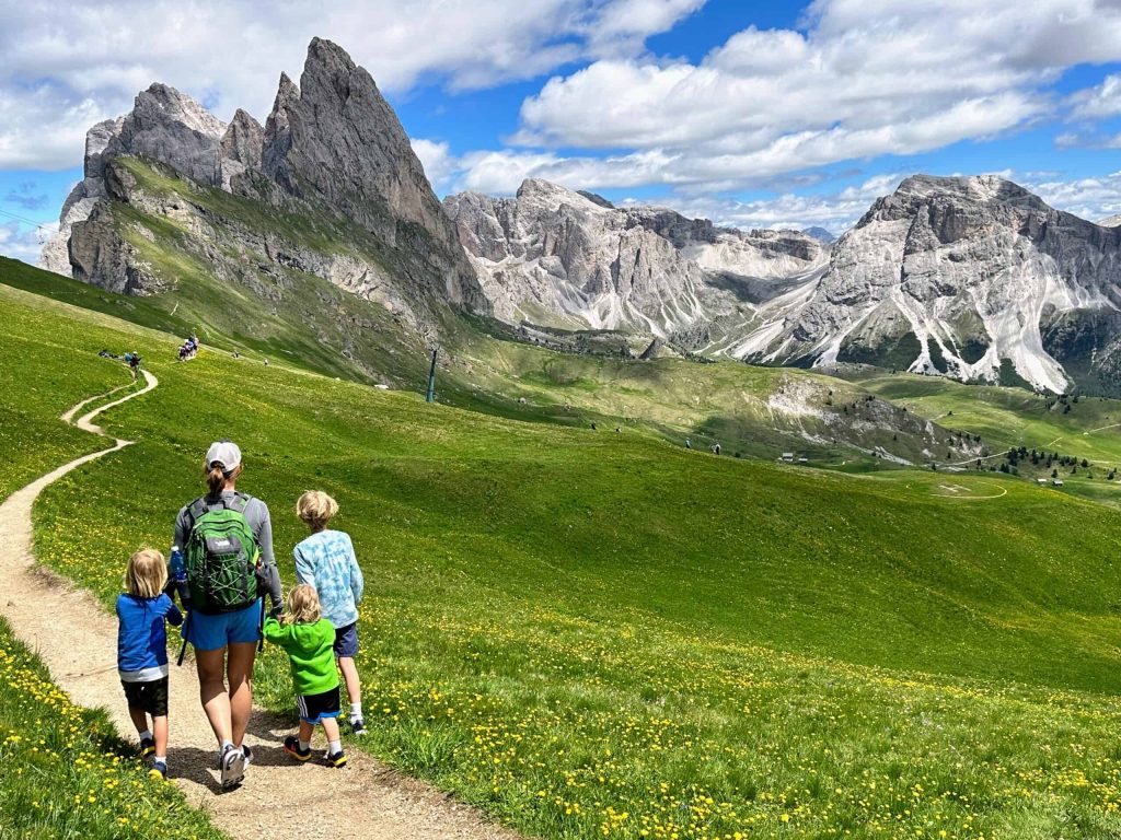
Seceda is a dreamy best place to visit in the Dolomites. All it takes is a short hike to reach the famous viewpoint. You can also take a cable car ride up into the mountains if you prefer.
Once you’re at the cable car station, you can enjoy the view without even hiking. But if you want to capture that iconic shot of Seceda, you’ll need to do a short but steep uphill hike to the viewpoint.
From there follow the trail along the ridgeline towards the jagged peaks. When you reach the trail junction, it’s an easy and beautiful walk back to the cable car station.
While many Instagram photos and travel websites focus on the slanting pinnacles of the Odle/Geisler group, I actually preferred the view from Seceda. Besides the pinnacles, you also get an incredible view of the Sella massif, Sassolungo, and Marmolada.
4. Lago di Sorapis- A Great Hike
Hiking Distance: 13.2 km circuit
Elevation Gain/Loss: 846 meters
Route Type: Loop trail
Difficulty Level: Difficult
Hike Duration: 5:10 hours
Parking Lot: Passo Tre Croci
Best time to visit: I’d start this hike in the morning so I have enough time to complete it.
Season: : Late June – mid-late October, depending on snow conditions.
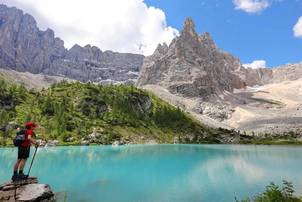
Lago di Sorapis is very popular during the summer and attracts lots of hikers. It’s one of the best day hikes in the dolomites. This beautiful hike around the lake sorapisis almost always crowdd.
If you want the best experience, hike the trail to Forcella Marcuoira. It takes you up high in the mountains and gives you a cool view of Lago di Sorapis that not everyone knows about.
Most people just hike back and forth to Lago di Sorapis on the main trail. But here’s a secret: you can turn it into a loop! That’s why there are different distances listed above.
If you go back to where you started using Forcella Marcuoira, you’ll see different stuff, like Monte Cristallo.
Turning it into a loop doesn’t make it much longer, but it does involve going uphill quite a bit more. But, your reward is the awesome views of Lago di Sorapis and panoramic views of the Dolomites.
If you’re down for a quieter hike with even better views across the Dolomites, go for the loop option when hiking Lago di Sorapis.
Note that- It’s forbidden to swim and Wild camping in Lake Sorapis.
5. Alpe di Siusi
Hiking Distance: 14.4 km circuit
Elevation Gain/Loss: 483 meters
Route Type: Meadows Circuit Trail
Difficulty Level: Easy
Hike Duration: 4:25 hours
Parking Lot: Alpe di siusi compatsch
Best time to visit: Late morning-noon is the perfect time to have a walk on the meadows and take in the vast mountain view.
Season: Late May to October
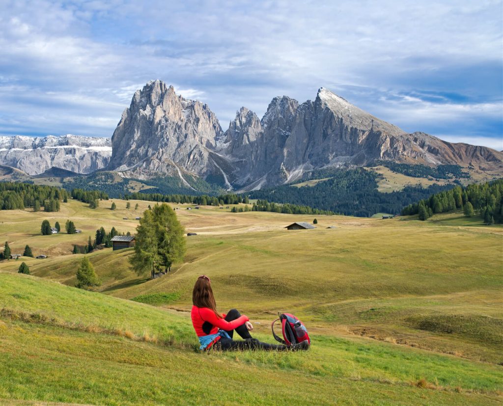
Alpe di Siusi, or Seiser Alm, is one of the most visited places in the Dolomites. Hiking this stunning meadow is definitely worth a day trip! Located in the western part of the Dolomites at 1680m altitude the meadow covers an area of 52 square kilometers.
Take a walk through this highest alpine meadow of Europe. I loved the scenic view of cabins, rifugios, and the lush green Sassolungo mountain.
There are hiking trails and biking trails that connect small villages along the hillsides. Also the jagged peaks of Sassolungo rise up high over the area.
You will have a lots of option to plan your time at Alpe di Siusi. We took a hike from Compatsch to Saltria which goes past several rifugios and offers beautiful views of Alpe di Siusi and Sassolungo along the trail.
Overall, it’s an easy downhill hike. From Saltria which is the lowest point, you can catch a bus back to Compatsch instead of climbing back up.
Seiser Alm also has a lot of hiking trails that you can explore. Most of them start in Compatsch, where you’ll be parking your car.
It’s a good idea to spend half a day or even an entire day on this meadow because there are a lots of of great South Tyrolean restaurants here too. So go ahead and enjoy the beautiful scenery and yummylicious food!
6. Lagazuoi Tunnels to the Falzarego Pass
Hiking Distance: 4 km
Elevation Gain/Loss: 639 meters
Route Type: Tunnel via Farrata
Difficulty Level: Easy
Hike Duration: 2.5-3 hours
Parking Lot: Directly at Passo Falzarego
Best time to visit: This hike an excellent choice when the weather is poor. And day time is the perfect hour to enjoy the hike.
Season: This hike is best during the summer months- June through September
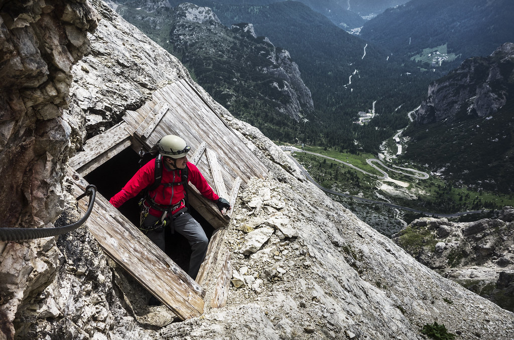
You can take a cable car up to Lagazuoi for an incredible view of the Dolomites. From there, you can enjoy the scenic downhill walk to the Falzarego Pass.
This hike starts with another cable car ride from the pass to Lagazuoi. This is one of the many peaks in the Dolomites. At the upper station of the cable car, you’ll be treated with yet another amazing view.
There are multiple trails in Lagazuoi that you can explore. We decided to hike downhill from the peak back to our car at Falzarego Pass. The hike is stunning along the trail. You can see Averau, Nuvolau, Cinque Torri, Gran Diedro, and Croda da Lago.
If you want to hike up the tunnel, start at Falzarego Pass and hike on Frontline Trail until you reach a crossroad that leads left towards the tunnel entrance.
The entrance is above Cengia Malvezzi ledge. Taking a short detour to this unique ledge with its military huts is highly recommended.
7. Cinque Torri
Hiking Distance: 1.9km
Elevation Gain/Loss: 360 m
Route Type: Loop
Difficulty Level: Easy
Hike Duration: 2 hours
Parking Lot: Baita Bai de Dones
Best time to visit: Noon is th best time so that you can enjoy the sunset.
Season: Mid-June – October
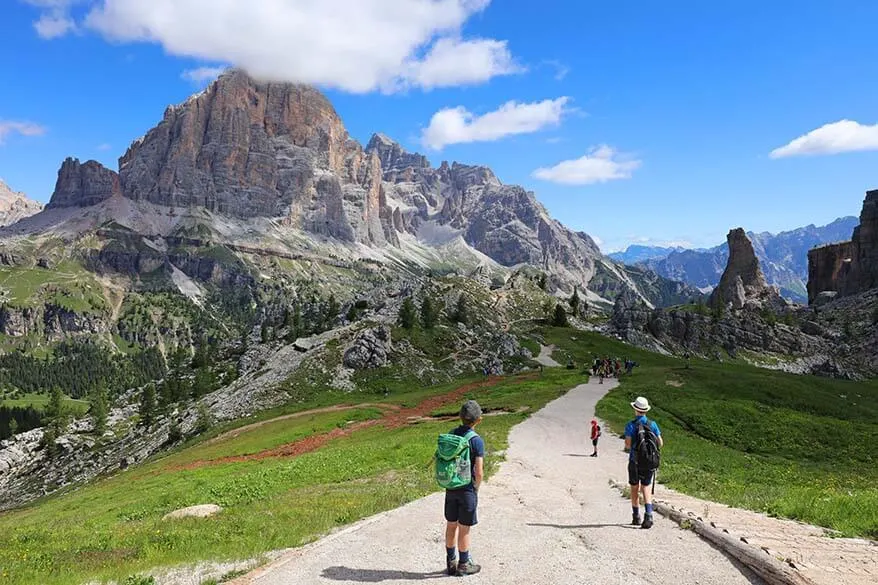
If you are close to Cortina D’Ampezzo when traveling the Italian Dolomites, must visiting Cinque Torri. It’s the famous 5 peak rock formation in the Dolomites.
Popular for hiking and rock climbing, it also has an outdoor museum. The museum is where a war happened during WWI.
The hiking around the Cinque Torri was one of the easiest and most beautiful hikes we did in the Dolomites. That’s why we recommend it to families with kids.
There arechairlift that can take your kids right up to the rock towers. And since it’s not too long of a hike, you will have time to see the bunkers and tunnels of the museum.
Cinque Torri is one of the best places to hike with kids in the Dolomites. They’ll learn about history while enjoying the nature.
You can also combine this hike with Rifugio Averau and Rifugio Nuvolau for an epic adventure filled day in the Dolomites.
8. Tofana di Rozes- Best Day Hikes
Hiking Distance: 11.9 km circuit
Elevation Gain/Loss: 1266 metres approx
Route Type: Normal route with slopes
Difficulty Level: Moderately Difficult
Hike Duration: 5 hours
Parking Lot: Ample gravel parking next to the Alpine Hut
Best time to visit: In the early morning as of rising of the sun for the fantastic view.
Season: Mid-June – Mid-September
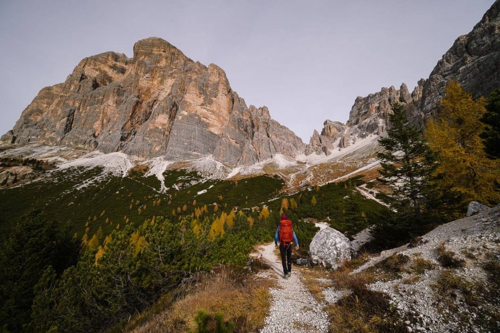
Tofana di Rozes is a significant mountain in the Tofane Group in Belluno, Veneto, up in Northeastern Italy. These mountains are situated just west of Cortina d’Ampezzo within the Dolomiti D’Ampezzo Natural Park.
To start off on the Tofana di Rozes loop trail, we first head over to Rifugio Dibona. It’s a mountain hut located in Vallon di Tofana. There’s a big parking lot right next to the hut and it’s totally free.
You will see a sign with number 407 for pine forest. Walk to that route till you come to the steep scree slopes used as pisat. There you see a fork.
Once you reach the fork, take a left onto this wide track that curves around and climbs some rocky terraces. Then there’s another fork where you pass through this hole in a rock.
From there, go up to the left path which is kinda plain and has some short stretches with gravel until you reach Alpine Hut bivouac. It’s a small hut hidden among rocks and perfect for an overnight stay.
This hike is usually considered moderate, but we would say it’s more on the moderately-difficult side. Most of the trail is in really good shape, but there are a few parts that have been washed out and need careful steps and experience in navigating slippery terrain.
Note that- You need high amount stamina for this hike. Kids or teens shouldn’t go for this hike.
9. Lago di Braies
Hiking Distance: 4km
Elevation Gain/Loss: 181m
Route Type: Loop Trail
Difficulty Level: Easy
Hike Duration: 1 hour
Parking Lot: Lago di Braies
Best time to visit: early morning before it gets crowded.
Season: End of May to end of October
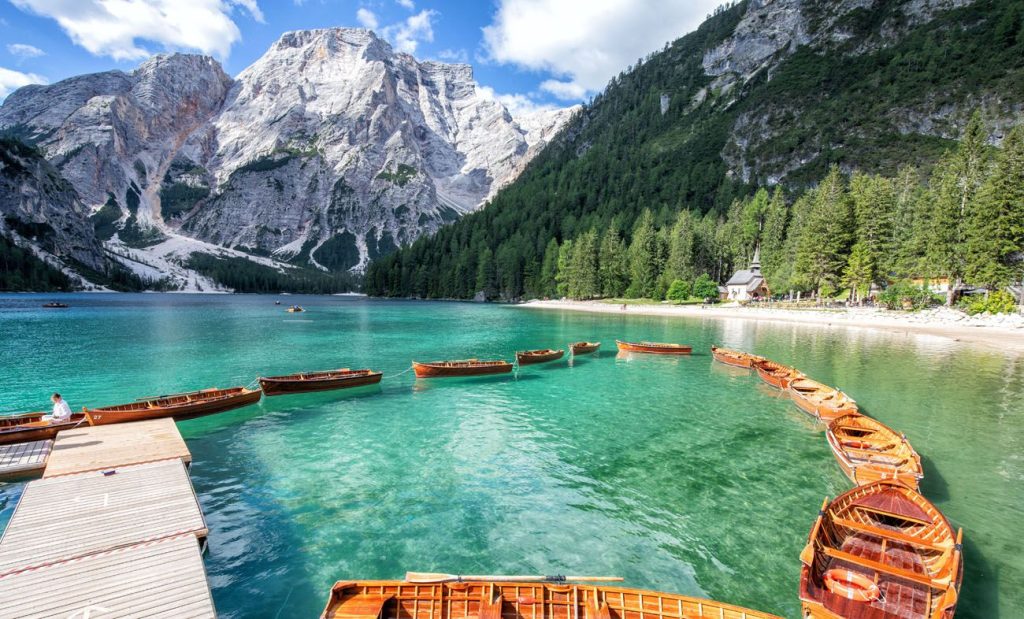
Lago di Braies, also known as Lago di Instagram, is one of the busiest and most popular hikes in the Dolomites. If you want to find a parking spot, try to come before 9am.
Many travelers visit the Dolomites for this lake as the highlight of their trip. They mainly go there to take photos for instagram.
You will see most people just hang around the boat house to take pictures and don’t bother with the whole trail beside the lake.
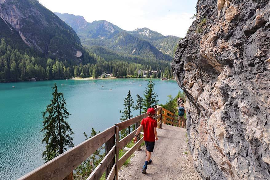
Lago di Braies aka Pragser Wildsee, is a really famous mountain lake in Europe. It’s located in the Fanes-Senes-Braies natural park in Alta Badia valley.
But here’s a secret: there’s actually a stunning hiking route that goes all around the entire lake! Most visitors don’t know about it.
It takes about an hour to finish this hiking loop and it’s quite easy. There are a few stairs here and there. You can even do it with kids!
To make sure you have an amazing experience at Lago di Braies, try to arrive as early as possible. Before or during sunrise would be the perfect time if you can manage it!
Not only will you avoid crowds on your hike but you’ll witness the most breathtaking mountain sunrises. When that first light touches the mountaintops, they turn into such beautiful shades of pinkish-orange.
10. Adolf Munkel Trail
Hiking Distance: 9.2km
Elevation Gain/Loss: 378m
Route Type: Loop trail
Difficulty Level: Easy
Hike Duration: 3 Hours
Parking Lot: Zanser Alm
Best time to visit: Start in the afternoon for witnessing the sunset.
Season: June to the end of October
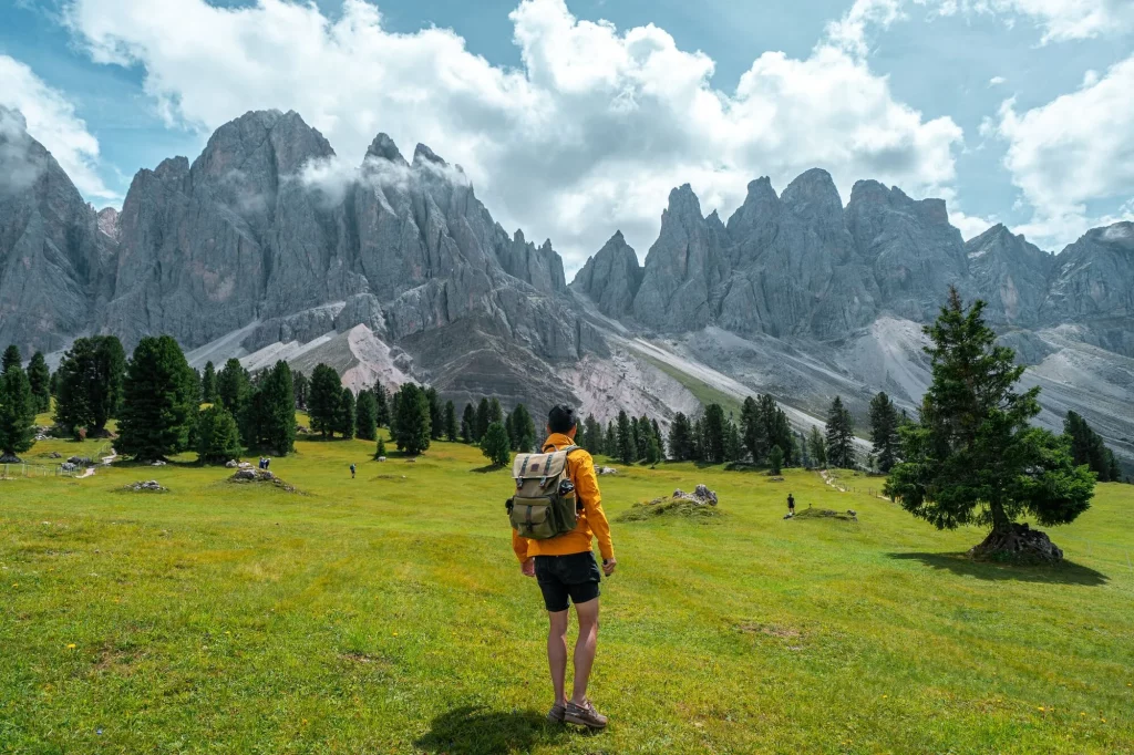
The Adolf Munkel Trail is one of the most scenic Dolomites hike. The trail is beneath the majestic Geisler/Odle mountain group.
The hike has some spectacular views of the mountain and lots of colorful wild plants and flowers. You can start and finish at Zanser Alm mountain hut, where you can grab some snacks for the hike or after your hike.
The highlight of this trail is reaching the beautiful Geisler Alm in Puez-Odle Nature Park. The Adolf Munkel Trail will take you through forests and alpine meadows.
You will love the earthy smell of the wind while enjoying stunning views of the Geisler/Odle mountains. It’s an straight forward hiking trail to enjoy with kids.
I highly recommend starting your hike in the afternoon so that you can be at Geisler Alm during sunset. You will be amazed with how beautifully they light up with sunlight on their peaks.
11. Lago di Carezza
Hiking Distance: 1.1km
Elevation Gain/Loss: 31m
Route Type: Loop Trail
Difficulty Level: Easy
Hike Duration: 25 minutes
Parking Lot: Lago di Carezza
Best time to visit: Either sunrise or sunset
Season: May until the end of October
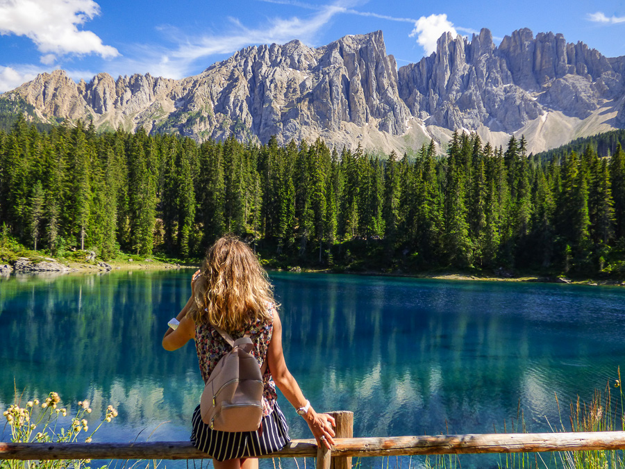
Lake Carezza is one of the best hikes in the Dolomites. It’s a very hyped up tourists attraction. You might know it as Karersee. The lake has rich emerald green water that will blow your mind.
Head toward the visitor center place. You’ll find a tunnel that goes down down straight to the lake so you don’t have to bother crossing the street.
As soon as you reach the end of the tunnel, you’ll get the killer view from the visitors’ terrace. It’s like picture-perfect and shows off that gorgeous lake and the mountains behind it.
This panorama is what you see in most pics of Lake Carezza. The mix of blue water, green trees, gray rocks, and (hopefully) clear sky is seriously one-of-a-kind.
And the best part is you can hike the trail around the lake within 20 minutes. The views from different spots of the trail are killer.
Fun story- it’s said that the lake got its stunning color as a wizard fell head over heels for a mermaid living in the lake. He tried to impress her by making a rainbow appear in the sky.
But the mermaid got scared by the sight of him and disappeared into the water forever. With all his rage the wizard ripped down that rainbow and threw it into the lake.
12. Sass Pordoi
Hiking Distance: 2.9 km
Elevation Gain/Loss: 65 meters
Route Type: point-to-point trail
Difficulty Level: Moderately Difficult
Hike Duration: 1.30 hours
Parking Lot: Next to the Sass Pordoi cable car station
Best time to visit: Early morning when the sunshine is all over the majestic mountains.
Season: May to September
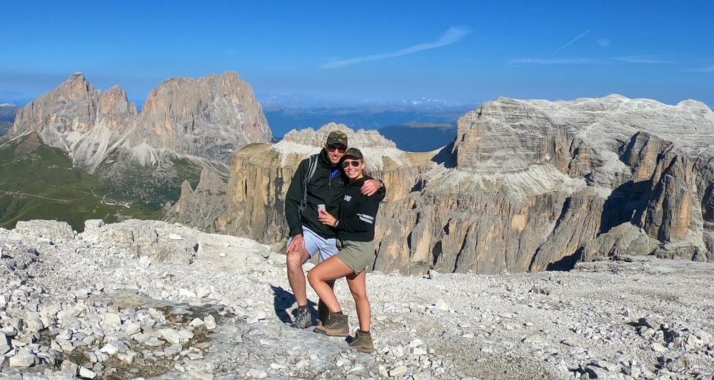
The Sass Pordoi hike is wonderful hike in the Dolomites both in summer and winter. You can start the hike from the cable car station. There’s cable cars that can take you up 700 meters from Pordoi Pass to the peak.
From the sun terrace you’ll get an incredible panoramic view of the Rosengarten, Alpe di Siusi, Langkofel, Fassa Valley, Marmolada, Sella massif, and highest peak called Piz Boè.
You can also start several hiking and climbing tours from here. The hiking routes are physically difficult I’d say. Need constant attention and good balance.
During winter, skiers and freeriders love coming to Pordoi Pass and its peak. Freeriders start their adventures at Pordoi Scharte.
The pass itself is one of four passes in the Dolomite that make up Sellaronda. In recent years, it has also become possible to do this route on a racing bike during summer months!
13. Piz Boè
Hiking Distance: 5.3 km
Elevation Gain/Loss: 130 meters
Route Type: Out and back.
Difficulty Level: Extremely Difficult
Hike Duration: 2 to 4 hours
Parking Lot: Passo Pordoi
Best time to visit: Early in the day when crowds are lower
Season: Mid June through Mid September
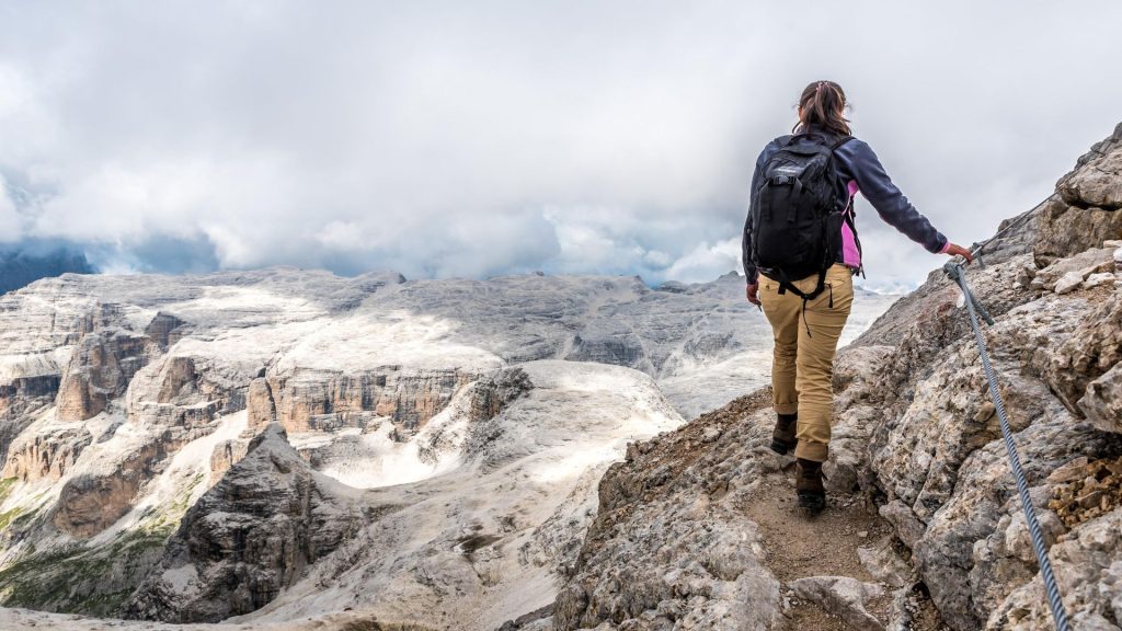
Piz Boe is a really popular place to visit, mainly because you can easily take the cable car from Passo Pordoi (which you can get to by car) up to the Sass Pordoi peak.
The peak is at 2950 meters and it’s pretty close to Piz Boe. Best way to explore is to take the cable car as it’s a quick trip up to the top. But I decided to do it properly and hiked all the way up from Passo Pardoi.
The trail is rocky and steep.Make sure you have good hiking shoes for safety. There are risky slippery areas under Sass Pordoi’s southern wall.
It’s about 2.6 kilometers from Passo Pordoi to Rifugio Forcella Pordoi mountain hut with a total ascent of around 600 meters.
Once you reach Rifugio Forcella Pordoi, there are two options for reaching the top: one is technically difficult but considered an actual via ferrata trail, another one is the north-west side of the mountain.
Warning: This trail is extremely difficult and requires proper equipment and experience with alpine mountaineering.
14. Puez-Odle Altopiano- Best Dolomites Hiking Trails
Hiking Distance: 17 km
Elevation Gain/Loss: 850 meters
Route Type: Circuit trail
Difficulty Level: Moderate to strenuous
Hike Duration: 6 to 9 hours
Parking Lot: Park next to the Dantercepies gondola
Best time to visit: Early in the morning as it takes long hours.
Season: Between mid-June and mid-September
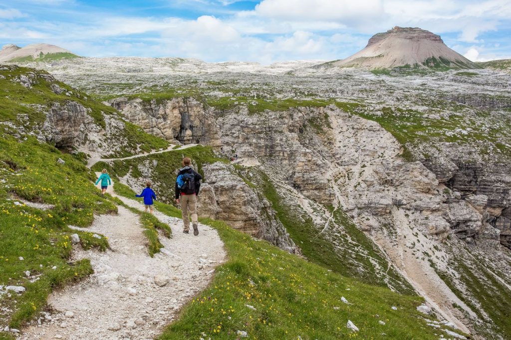
The Puez-Odle Altopiano is an absolutely amazing hike from start to finish. After the long difficult hike, we couldn’t believe our eyes when we got the breath taking view.
Gorgeous fields filled with wildflowers, and endless stunning scenes of alpine beauty made me fel some type of way. Honestly, this hike is hands down our absolute favorite in the entire Dolomites!
The hike is 10.6 miles and you will hike through some of the highest mountain peaks in this magnificent range. If you decide to go for this hike, prepare yourself for a climb of 850 meters.
There’s a chairlift that cuts off 700m from the initial ascent and a descent of 1,500 meters. The distance and elevation made it just challenging enough to keep things exciting, but it was worth it. The views stole the show.
We were actually pretty damn fortunate to have clear blue skies for most parts of our adventure on this trail. It meant we got to soak in jaw-dropping vistas not only of the surrounding mountains but also other incredible landscapes in the area too!
15. Val Fiscalina to Drei Zinnen
Hiking Distance: 17km
Elevation Gain/Loss: 800 meters
Route Type: Out & Back
Difficulty Level: Moderatelty Difficult
Hike Duration: 6 hours
Parking Lot: Parkplatz Fischleinbodenhütte
Best time to visit: Early in the morning as it takes long hours
Season: June till the end of October
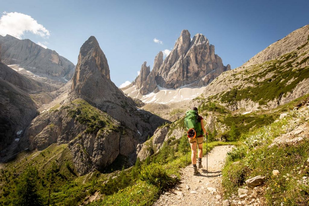
Val Fiscalina (Fischleintal) is a beautiful side valley of Sesto/Sexten Valley in Alta Pusteria/Hochpustertal in the Italian Dolomites.
The valley is about 4.5 km long. Starts at Moso/Moos in Sesto/Sexten and takes you through Tre Cime Nature Park until you reach Rifugio Fondovalle/Talschlusshütte.
Right after Rifugio Fondovalle/Talschlusshütte, the valley splits into two sections. The upper part on the west is called Val Sasso Vecchio/Altensteintal, while the upper part on the east is known as Val Fiscalina Alta/Bacherntal.
Val Fiscalina is a popular tourist destination all year round. You can enjoy cross-country skiing all the way to Rifugio Fondovalle during winter.
If you are visiting during summer, you can bring your kids to take a leisurely walk along the entire valley. You can also go hiking to Tre Cime di Lavaredo/Drei Zinnen or explore various mountain huts in the Sesto/Sexten Dolomites region.
16. Lago Limides Hiking Trail
Hiking Distance: 2km
Elevation Gain/Loss: 50 meters
Route Type: Out & Back
Difficulty Level: Very easy
Hike Duration: 1 hour
Parking Lot: Rifugio Col Gallina
Best time to visit: When the sun is rising and lit up the Lagazuoi mountains
Season: June to the end of October
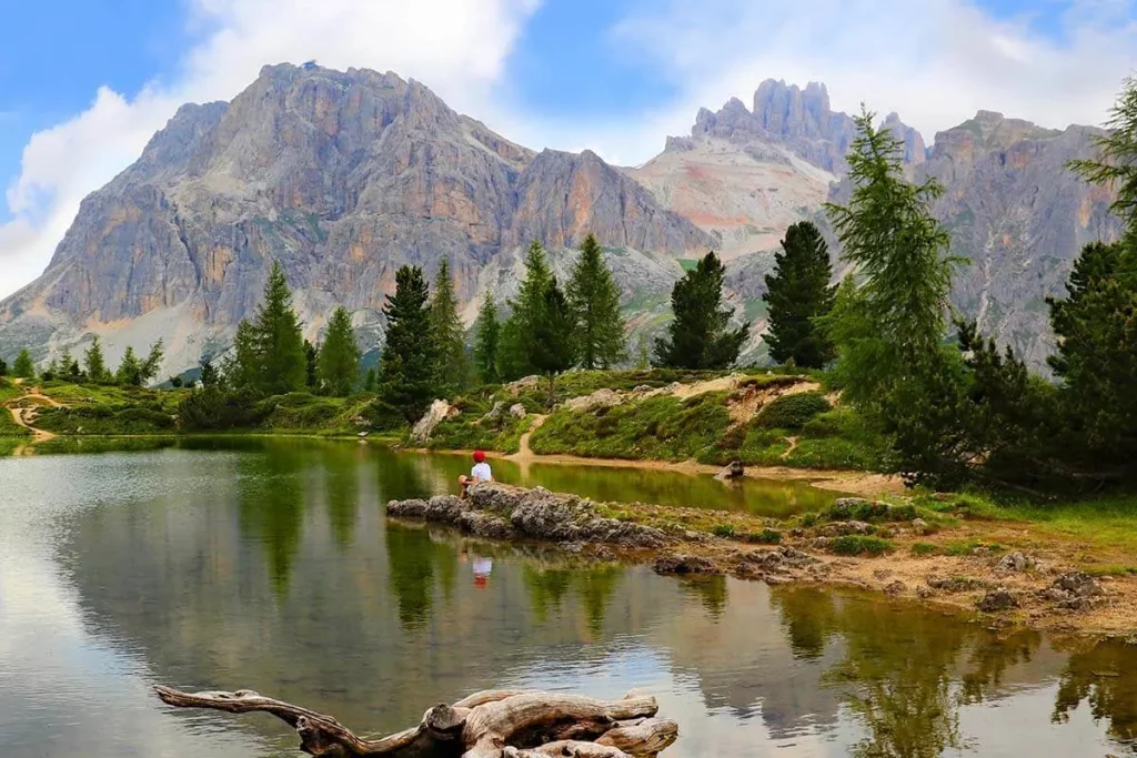
The lago Limides hiking trail is one of the easiest hiking trails in the Dolomites with the best reward. It’s not too far from Cortina d’Ampezzo.
To get there, we parked at the Falzarego Lagazuoi cable car station and followed a dirt trail on the other side of the road. It was a bit narrow but easy to find.
We hiked uphill for a short while and then took a left turn to reached the lake. The whole hike only took us about 20 minutes from where we parked.
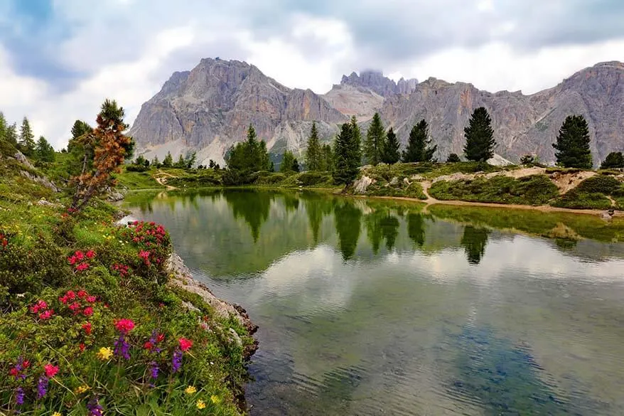
It’s the shortest hike but totally worth it. Just take a look at the pictures from my camera roll and you’ll see why!
I went on this hike in late October and what I didn’t realize is that most of these lakes are fed by glaciers. So by Fall, they’re usually dried up or very small. In my case, there was no water left at all.
This place is absolutely stunning for watching the sunrise and it only takes about 30 minutes to reach the top even if you are walking slowly.
The lake is pretty small and doesn’t have water all year-round, but when it fills up, you can see the reflections of the Tofana and Lagazuoi mountains on it.
17. Marmolada Glacier
Hiking Distance: 9.4km
Elevation Gain/Loss: 700 meters
Route Type: Loop
Difficulty Level: Difficult
Hike Duration: 7.5h,/9.4km
Parking Lot: Fedaia reservoir
Best time to visit: Early morning.
Season: May to October
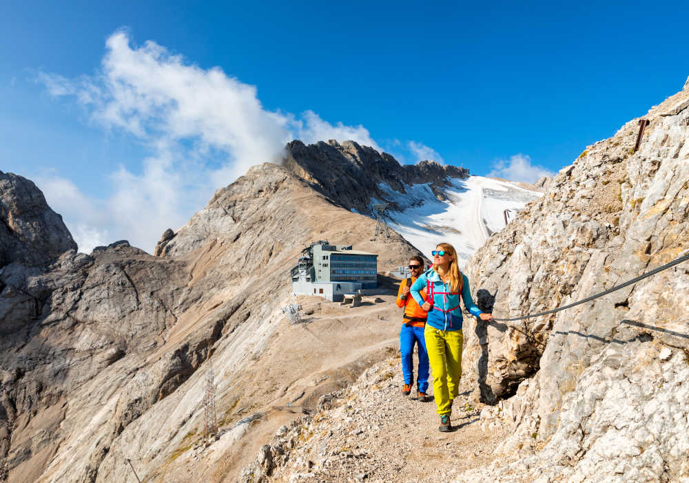
Marmolada is is the tallest mountain and known as the Queen of the Dolomites. It may look stunning in pictures, but hiking it is not for the faint-hearted.
If you’re an pro hiker who loves a good challenge and wants to connect with nature on the highest peak in the Dolomites- then you are in for a 9.4km long trail.
Start at the parking lot near Fedaia reservoir and follow the rocky path uphill next to Fedaia-Pian dei Fiacconi basket lift until you reach Sforcela de Coi di Bousc.
From there, climb straight up the slopes covered with loose rocks until you reach the lower edge of Vernel glacier.
This is where you need to put on your via ferrata gear and maybe even crampons depending on conditions. Walk mostly in the center of the glacier and then cross to the right towards via ferrata entrance when you get closer.
The summit trek on Marmolada has amazing corners for photo opportunities so make sure to time yourself well to avoid any trouble during descent.
Once at the top, don’t forget to take a mandatory group photo! The view extends north over all famous Dolomite mountains towards Stubai and Zillertal Alps. On its south side, you’ll be struck by its steep face connected to Sasso Vernale.
18. Stiergarten
Hiking Distance: 13km
Elevation Gain/Loss: 144 meters
Route Type: out & back
Difficulty Level: Easy
Hike Duration: 4 to 5 hours
Parking Lot: Parkplatz Tre Cime cable car in Sesto
Best time to visit: Start in the morning for amazing view
Season: June until the end of October
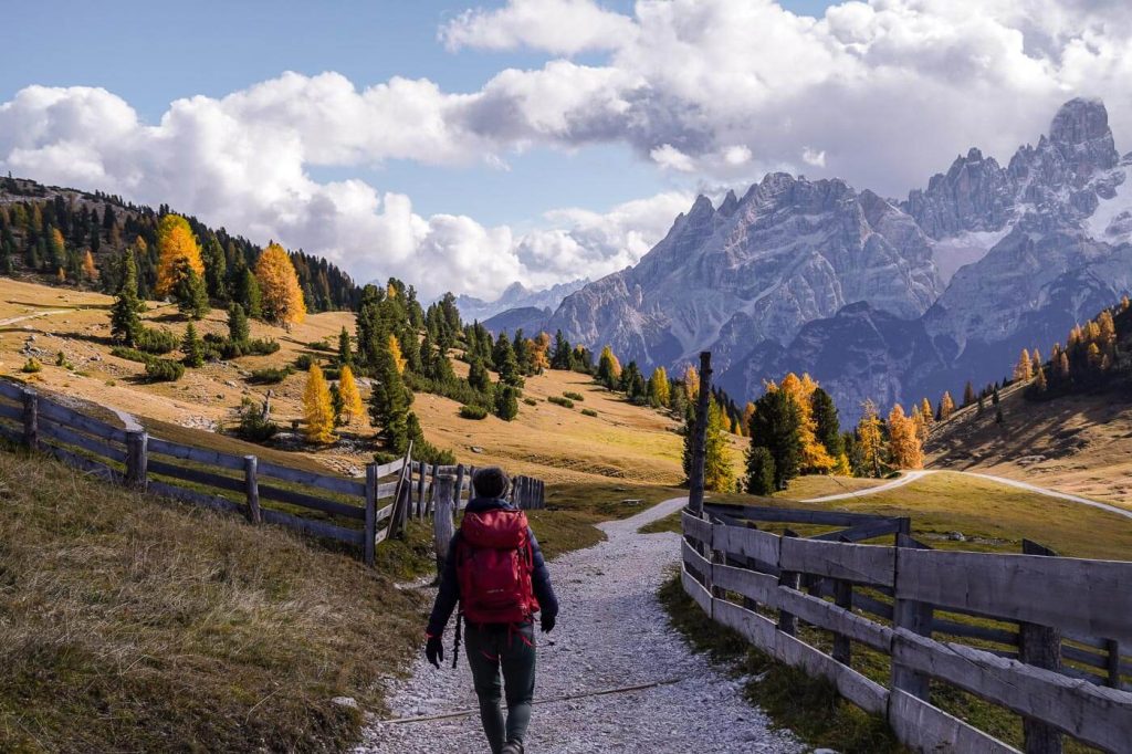
One of the most well-kept secrets in the Dolomites is the Stiergarten trail. It starts at the bottom of the Tre Cime cable car in Sesto and goes up to the meadows of Stiergarten.
The hike typically takes about 4 to 5 hours. And it can take longer if you want to stop at the view points. during summer you can see cows grazing from the top. When you complete the trail you will see the incredible view of all Tre Cime National Park.
During summer months when things are easier, you can just hop on the cable car and enjoy a leisurely trip up to the meadow.
19. Col Raiser to Seceda
Hiking Distance: 17km
Elevation Gain/Loss: 800 meters
Route Type: Out & Back
Difficulty Level: Hard
Hike Duration: 6.5 hours
Parking Lot: Col Raiser gondola
Best time to visit: For this long hike be up there either for sunrise or sunset
Season: June until the end of October
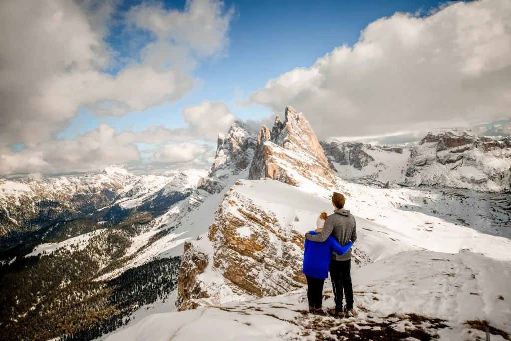
The Col Raiser to Seceda hike is one of my favorite trails in the Dolomites. Seceda is famous and so are Gran Cir, Passo Gardena, and Adolf Munkel trail in Puez-Odle Nature Park.
When you start your hike at the Col Raiser cable car, it’s a steep climb. In high season, you can take the cable car up but you’d miss out on amazing viewpoints if you do that!
Then you’ll walk through a beautiful pine forest and be surrounded by stunning mountain ranges everywhere. I was amazed (and out of breath) throughout the entire hike up. This is my top recommendation for anyone looking for a unique experience in the Dolomites.
Ultimately, you’ll walk along the Seceda ridgeline until you reach a well-known viewpoint. The whole hike takes about 4 hours to complete, though it took us a bit longer because I ended up knee-deep in snow for half of it.
20. Gran Cir Via Ferrata
Hiking Distance: 4.5km
Elevation Gain/Loss: 70 meters
Route Type: Out & Back
Difficulty Level: Hard
Hike Duration: 3 hours
Parking Lot: The parking lot adjacent to Rifugio Frara
Best time to visit: Start at the dark for the best sunrise view you will ever see.
Season: June until the end of October
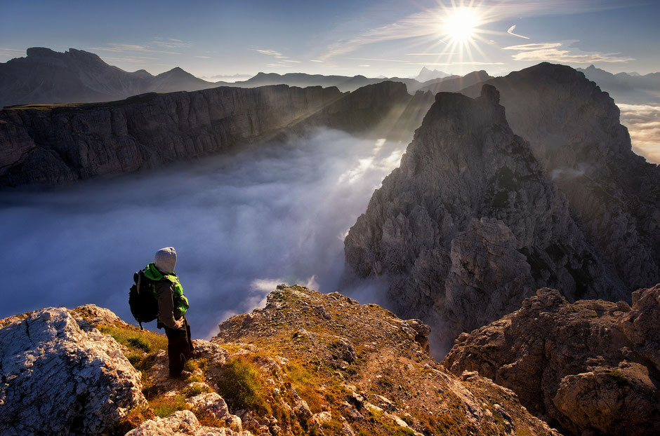
The Gran Cir Via Ferrata is definitely one of my favorite hikes in the Dolomites because the views at the top are absolutely stunning.
To get there, you have to park at Passo Gardena, which you can reach from Val Gardena or Val Badia on a paved road called SS243.
The parking lot next to Rifugio Frara on the Sella side is gated and requires payment starting at 7 am. However, when I went there in late October, the gate was open all day and I didn’t have to pay.
This hike is perfect for catching an epic sunrise at the top. It was truly magical watching as sunlight illuminated the valley below. It’s an experience I’ll never forget. Just remember to bring a headlamp if you’re hiking in darkness.
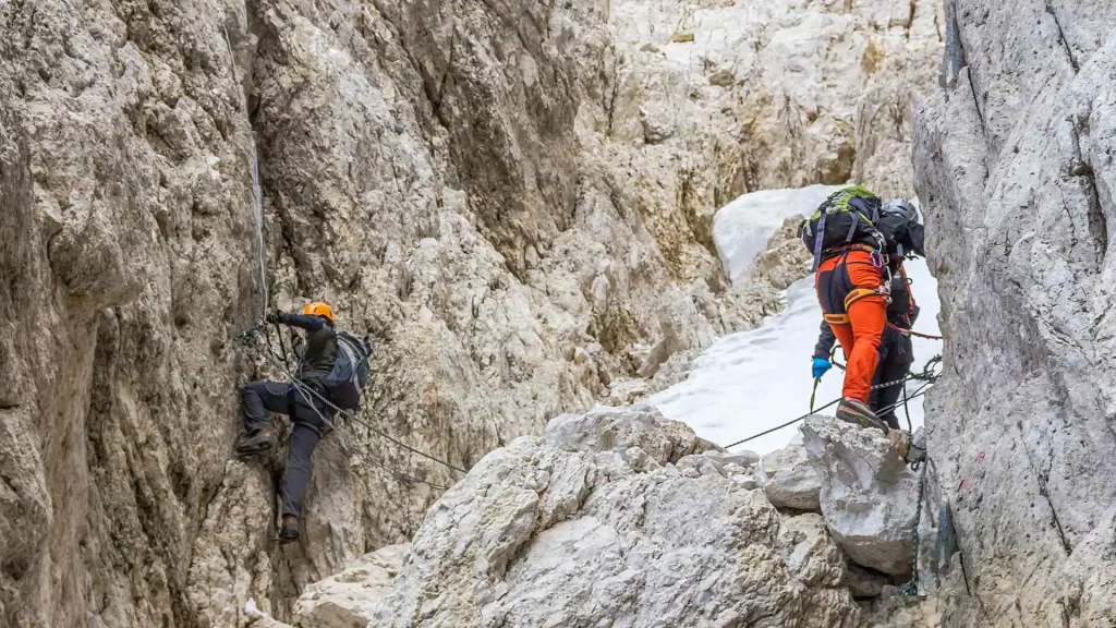
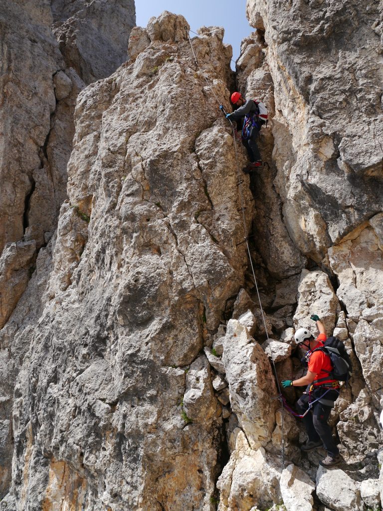
If you’ve never done a via ferrata before, don’t get anxious! There’s only a short section where you need to use chains for climbing and no special gear is required for this hike.
⚠️Warning– it’s quite steep so if you have trekking poles, bring them along. I didn’t have any and regretted it all the way up.
Although it’s a relatively short hike, but the reward is huge. The ascent can be tough and honestly, I couldn’t make it all the way up myself. As mentioned earlier, not having trekking poles and carrying heavy camera gear made it even harder for me. But eventually I found an amazing spot to sit and enjoy the sunrise.
21. Cadini di Misurina
Hiking Distance: 3.2 km
Elevation Gain/Loss: 50 meters
Route Type: Out and back
Difficulty Level: Easy
Hike Duration: 1-2 hours
Parking Lot: Park in the lot for Rifugio Auronzo
Best time to visit: In the morning or in the noon.
Season: June until the end of October depending on the snowfall.
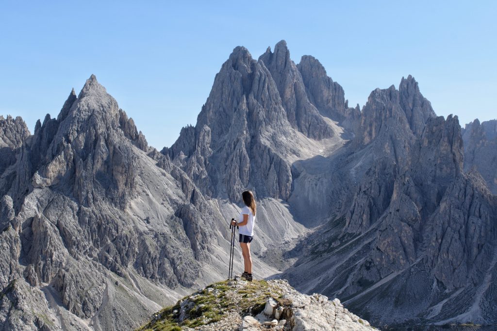
Cadini di Misurina is one of our favorite short hikes in the Dolomites. The views are amazing with the majestic views of mountainTre Cime di Lavaredo. You will also be mesmerized with the view of Cadini di Misurina itself.
We did this hike in July 2022, right after we hiked Tre Cime di Lavaredo. Surprisingly, we only ran into a few people on the Cadini di Misurina trail.
It was a refreshing change from all the crowded hikes we’ve done in the Dolomites. But I heard now-a-days in this time the trail remains crowded still better than other dolomites hike.
If you’re looking for a short and stunning hike where you can avoid too many other tourists, definitely put the Cadini di Misurina hike at the top of your list.
22. Passo Gardena
Hiking Distance: 4.3 km
Elevation Gain/Loss: 60 meters
Route Type: Loop
Difficulty Level: Easy
Hike Duration: 1-2 hours
Parking Lot: Cristauta/PraplanParking Lot
Best time to visit: Morning or noon.
Season: June to October
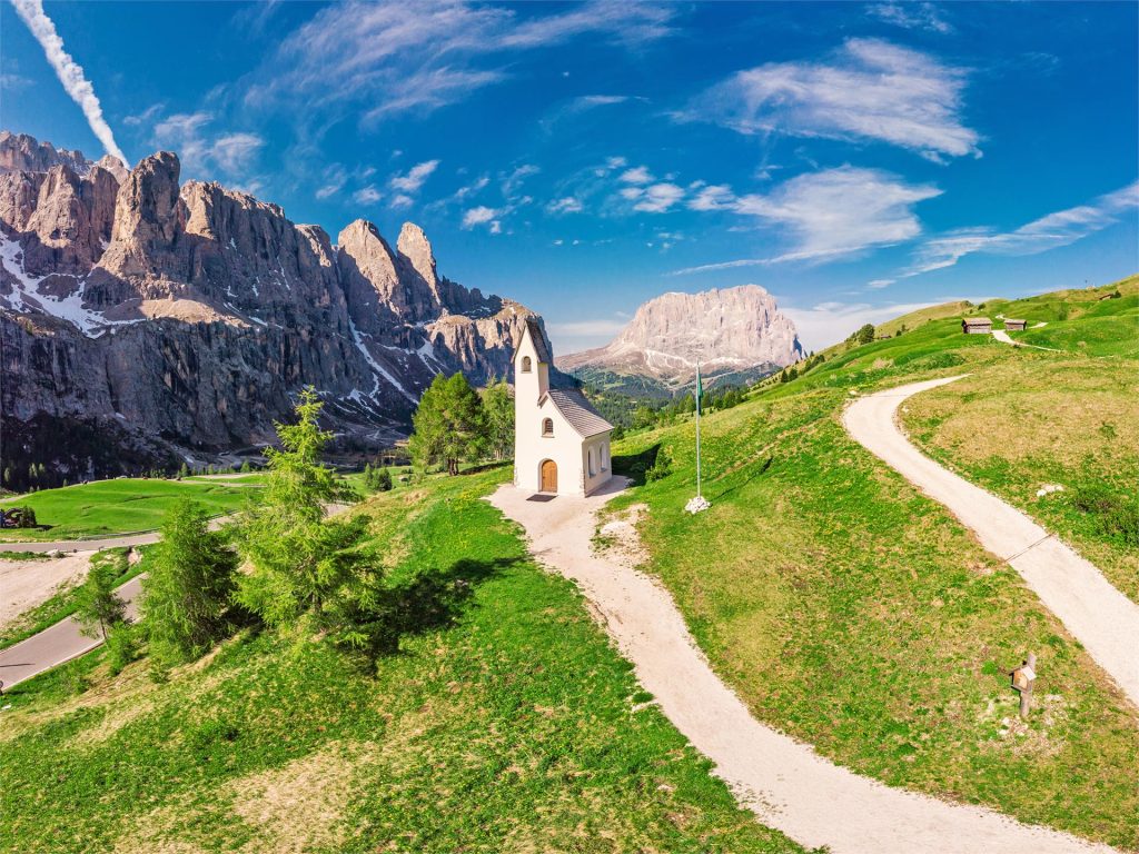
This is another best hike in the Dolomites that requires very little effort and has a big payoff. Passo Gardena is one of the most beautiful places near Val Gardena, and this trail takes you up the Sella side, which is opposite of the Gran Cir via ferrata.
The trail starts at the same parking lot as rifugio Frara. On the left side of the rifugio, you’ll see a small trail that leads you up.
This is where the photos below were taken. You can also choose to keep hiking further up by following the MTB Trail am Grödner Joch.
23. Val di Funes
Hiking Distance: 24-km
Elevation Gain/Loss: 160 meters
Route Type: circuit
Difficulty Level: Easy
Hike Duration: 3 hours
Best time to visit: Late Afternoon until Sunset
Season: Summer and Fall
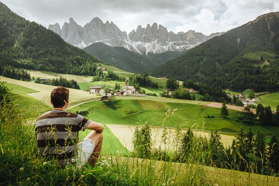
If you’ve ever seen a postcard of the Dolomites, there’s a good chance Val di Funes is in it. You’ll see the stunning Seceda ridgeline in the background and a cute little church in a green meadow.
It’s definitely one of the most famous spots to photograph in the Dolomites, but just like with Lago di Braies, there are actually many amazing hiking trails around Val di Funes.
One of the most scenic hikes in Val di Funes takes you up to the Santa Magdalena viewpoint. From there, you can make your way down to Zanser Alm and even continue up to Kanserill Alm if you’re feeling adventurous.
24. Rifugio Averau and Rifugio Nuvolau
Hiking Distance: 4 km
Elevation Gain/Loss: 50 meters
Route Type: Out & back
Difficulty Level: Easy
Hike Duration: 1 hour
Best time to visit: Early morning for the sunny mountain view
Season: Summer
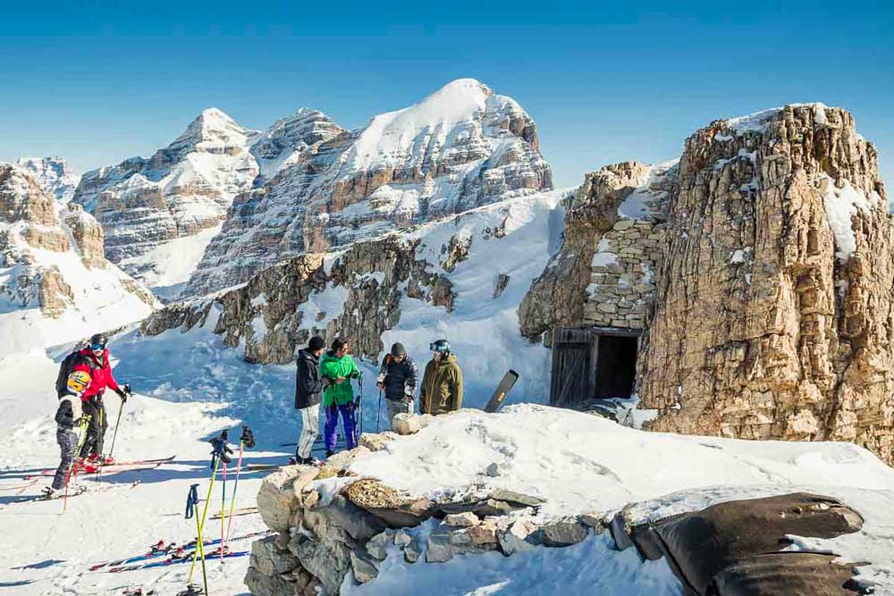
If you want to enjoy one of the best views of the Dolomites while sipping on a beer, having a meal, then you definitely don’t want to miss out on this hike. It’s personally one of my favorite short hike experiences in the Dolomites.
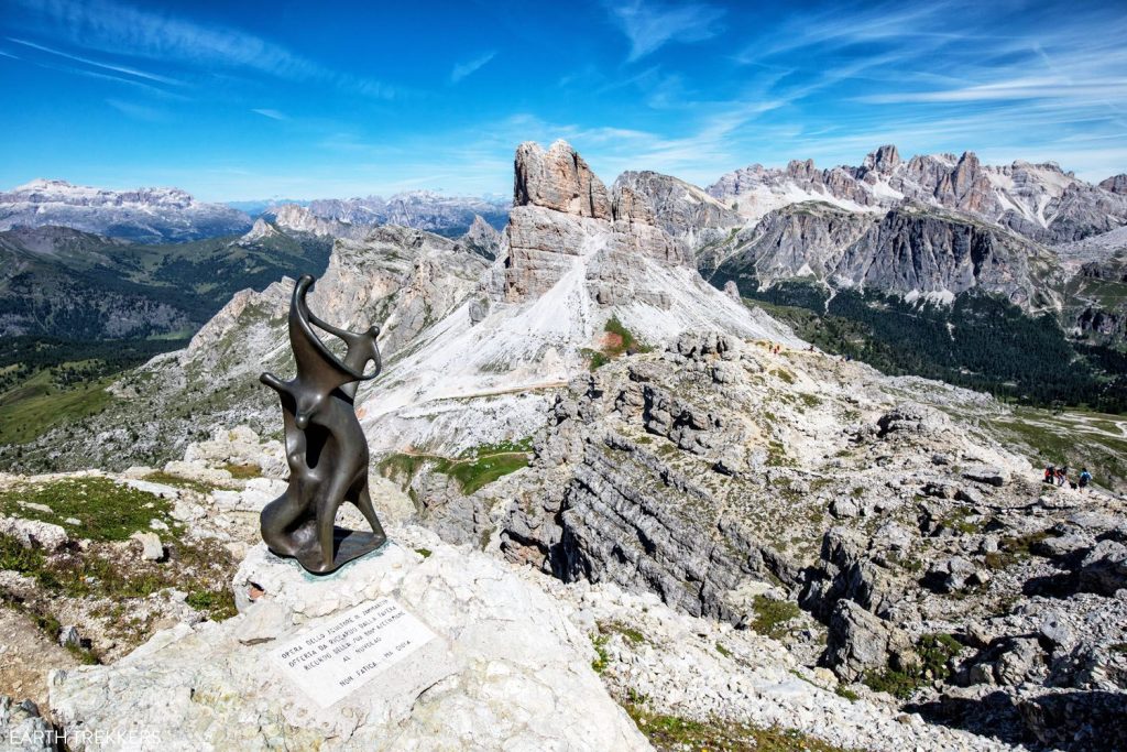
Rifugio Nuvalou is located at the top of Mount Nuvolau and offers a stunning 360° view of the Dolomites from its elevation of 2,575 meters (8,500 feet). The view is absolutely amazing, especially if you’re lucky enough to be here on a clear day.
Having lunch on the outdoor terrace with such an incredible view was truly an unique experience.
To get here, just hike past Rifugio Averau which serves some of the best pastas in the entire Dolomites.
Map of All The Best Hikes
Use this 2025 map to find the above mentioned hikes in the Dolomites:
Tips for Dolomites Hiking Trip
To have the smooth hiking trip to the Dolomites, here are some tips from me that will help you-
1. Must wear sturdy hiking shoes, specifically mountain trail shoes. Some trails are rocky and steep, so it gets hard to maintain balance.
2. Get a pair of trekking poles. They offer added stability. I can’t even imagine hiking without them!
3. If you plan on hiking in snowy conditions to avoid snow blindness, bring polarized sunglasses.
4. Pack for four seasons when visiting Dolomites. Early morning hikes can get cold even during summer. Wear layers so you can adjust accordingly during the hikes.
5. Arrive early to the popular hiking spots to have a smooth experience – you will get parking easily and the free trails are more fun to hike.
6. Although the hiking trails are marked, I’d still suggest using a navigation app like Gaia GPS for route planning.
7. If you’re picking sunrise or sunset hikes, take your headlamp for safe navigation during darker hours.
8. Must pack an emergency small first aid kit to protect any wounded area that you might get while climbing.
Recommended Dolomites Hiking Trails
Beginers Day Hike
If you’re new to hiking or don’t want to put in a lot of effort then these hiking trails in the Dolomites are best for you:
- Lago di Braies walk
- Lago di Carezza walk
- Val di Funes scenic trail
- Lago Limides trail
- Lago di Dobbiaco walk
- Cadini di Missurina
Challenging Hiking Trails
- Piz Boè
- Sass Pordoi
- Puez-Odle Altopiano
- Val Fiscalina to Drei Zinnen
- Marmolada Glacier
- Col Raiser to Seceda
- Gran Cir Via Ferrata
- Lago di Sorapis
Less Crowded Hikes
- Val Fiscalina trail
- Col Raiser to Seceda hike
- Gran Cir via ferrata
- Lagazuoi Tunnels
- Lago Limides
